Drone-Assisted SCAT: Advancing Shoreline Assessment Technology
January 8, 2025 | By the Leading Edge Team
January 8, 2025 | By the Leading Edge Team
The Leading Edge team recently got up to some science with our partners over at Polaris Applied Sciences Inc, specifically exploring better ways to integrate drones into the shoreline cleanup assessment techniques (SCAT) recon phase.
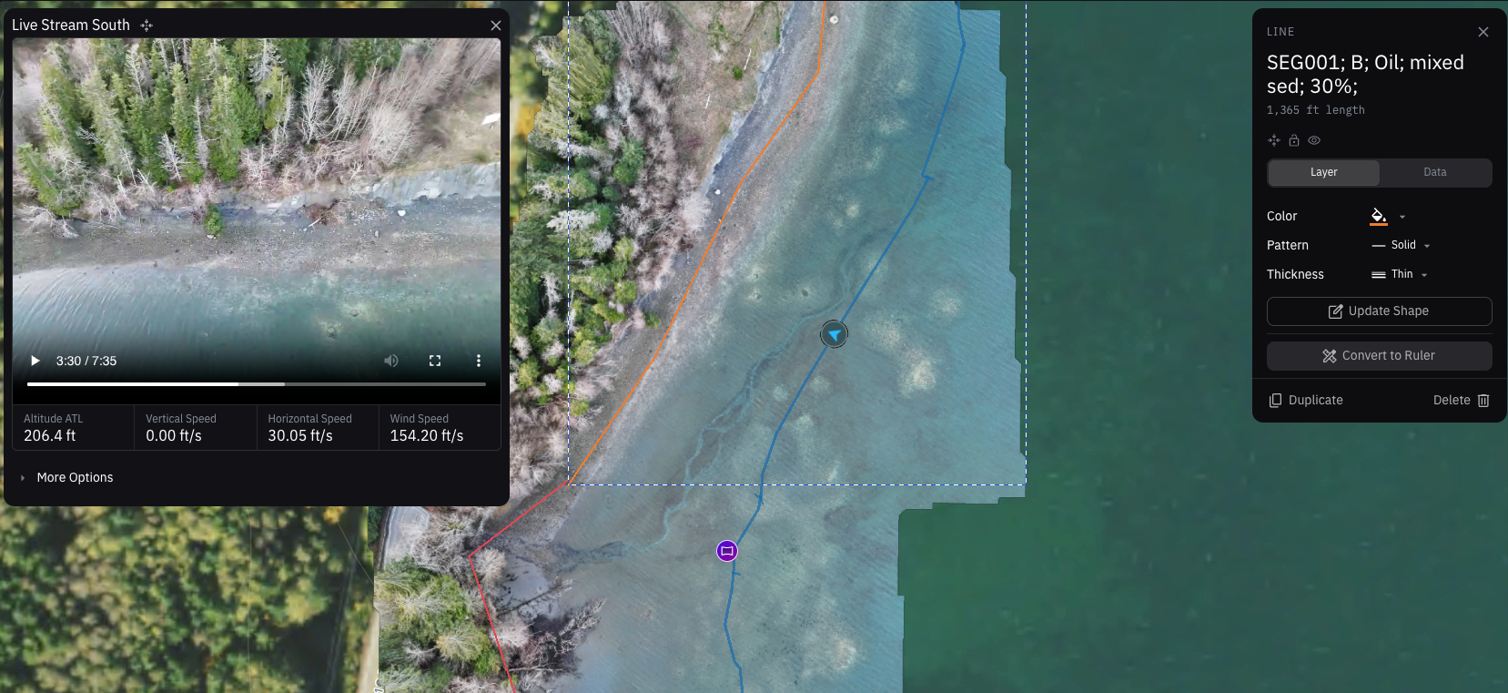
Turns out that the right mix of equipment and software tools can be hugely efficient for collecting SCAT data, especially with surface oiling. A drone team can cover a lot of ground quickly and provide remarkably accurate measurements, capture points of interest, and live-stream video back to a SCAT specialist.
The SCAT specialist can relay instructions to the drone team and annotate GIS data in real time from behind a computer. It's reasonable to assume that a single SCAT specialist can coordinate with multiple drone teams in this manner, and much of the data that's collected is already quality controlled and ready for the situation unit.
The system we've developed integrates live drone video feeds with GIS mapping tools, allowing for:
As always, we are hard at work developing new tools and approaches to be better prepared for the next big spill. Intercompany cooperation is just one of the many strengths of the Rapid Response Group.
This kind of research and development is what sets RRG apart—we're not just responding to incidents, we're actively advancing the science and technology of environmental response. When the next major spill occurs, we'll be ready with proven, tested methods that deliver better results faster.
Contact Rapid Response Group to discuss how our UAS operations can enhance your response.
24/7 Emergency Hotline: (844) 337-6336
RRS National Contact Number: (877) 410-0266
Email: drc@rapidresponsenow.com
About Leading Edge:
Leading Edge specializes in advanced technology solutions, UAS operations, and digital integration for emergency response. As a founding member of the Rapid Response Group, Leading Edge develops and deploys the digital tools that power RRG's operational superiority. Learn more at our member page.